Tag Archives: surveillance
Forever Overhead Miscellanea

Forever Overhead Miscellanea


“Forever Overhead” is the rubric under which I put everything having to do with surveillance from above (satellites, drones, etc.), but is intended especially to focus on the “democratizing” aspects of the overhead which are open source (such as Google Earth and Google Maps) and the myriad data are put by myriad enterprising Googlers and scholars. It’s a sort of vertical panopticon http://gestaltist.com/2011/05/29/forever-overhead-panopticon-2-0/ –but one in which we can all play the role of warden.

I’m just returning (physically and cognitively) from a long trek to Russia, Mongolia and China via the Trans-Siberian Railway, and Gestaltist grows stale. Unfortunately, I’m slow to recover my capacity for blogging as so many other things. Sine I’ve got a hoard of potential links and short bits on this topic, so rather than sit on them while I convalesce, I’m rounding them up here.

Chinese Enigmas
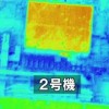
First up and most recent are the recently uncovered imagery, via Google Earth, of these strange structures in China. This Danger Room post is itself a comprehensive roundup of the images and various speculations on their purpose(s).

One of the ones I’m most struck by–whose message is clearly less abstruse–is this one. Apparently it reads something like, “Remove ten thousand (i.e. ‘all’) obstacles to strive for victory/success”.

This is in Xinjiang province, (not so) incidentally the site of one of China’s largest ethnic/separatist movements (also incidentally, when I was in China one of my Great Firewall experiments consisted of searching “Xinjiang riots” on Baidu (China’s Google), where the first hit was a Chinese press article asserting that the uprising was staged by provocateurs external to China. The slogan’s a bit of a misnomer, though: there are more than ten thousand Uighurs in Xinjiang.

More images and speculation can be found here.

Pakistan’s Nukes and Google
Many have already read of my fondness for Jeffrey Lewis’s armscontrolwonk blog. Apparently Assistant Secretary of State for Arms Control, Verification and Compliance Rose Gottemoeller cited one of his student’s (Tamara Patton) work modeling Pakistan’s Khushab complex using open source tools and Google SketchUp; since her mention is itself a pretty good summary of the effort, I’ll
meta-quote it here:

She is using freely accessible geospatial tools to gather and analyze
information about the complex’s capacity levels. The really
interesting part comes when she takes the open source satellite images
of the complex and turns those into 3-D models using a freely
available program called Google Sketch-up. This program constructs the
models with dimensions that Patton ascertained using tools in Google
Earth and basic trigonometry. The model is then placed on the map and
textured using observable features.

Through the Keyhole
When you’re watching TV or a movie and see some plucky analyst viewing live satellite imagery of somebody or thing, and some officious supervisor looks on or orders the satellite to be retasked to some other target (a newer, more 21st-century of the “enhance” meme) the closest actual thing (that we know about) is the Keyhole satellite.

One of these (albeit much older–a KH-9, we’re currently up to KH-11 at least) was put on display at the National Air and Space Museum… somewhat dramatically, for only one day.

An appropriately antiquated KH-9 image / Wikimedia Commons


Earth and the Anthroposphere
Globaia has produced a series of maps and visualizations attempting to map all current and existing human activity.

The Global Transportation System / Globaia

After the 34th congress of the International Union of Geological
Sciences, “anthropocene” may become an “official” epoch:

But the concept itself, the idea that human activity affects the Earth
to the point where it can cross a new age, is not new and dates back
to the late nineteenth century. Different terms were proposed over the
decades, such as Anthropozoic (Stoppani, 1873), Noosphere (de Chardin,
1922; Vernadsky, 1936), Eremozoic (Wilson, 1992), and Anthrocene
(Revkin, 1992). It seems that the success of the term chosen by
Crutzen and Stoermer is due to the luck of having been made at the
appropriate time, when humankind became more than ever aware of the
extent of its impact on global environment. It should be noted that
Edward O. Wilson (who suggested Eremozoic, “the age of loneliness”)
popularized the terms “biodiversity” and “biophilia.”

They define the Anthropocene epoch (we’re currently in the Holocene,
though after August 2012 this may no longer be true) thusly:

A period marked by a regime change in the activity of industrial
societies which began at the turn of the nineteenth century and which
has caused global disruptions in the Earth System on a scale
unprecedented in human history: climate change, biodiversity loss,
pollution of the sea, land and air, resources depredation, land cover
denudation, radical transformation of the ecumene, among others. These
changes command a major realignment of our consciousness and
worldviews, and call for different ways to inhabit the Earth.

More maps and related articles can be found at the Anthromes site.

And there’s the “i-tree” software from the US Forest Service:

i-Tree Canopy offers a quick and easy way to produce a statistically
valid estimate of land cover types (e.g., tree cover) using aerial
images available in Google Maps. The data can be used by urban forest
managers to estimate tree canopy cover, set canopy goals, and track
success; and to estimate inputs for use in i-Tree Hydro and elsewhere
where land cover data are needed.

US Forest Service


Satellite Archaeology
NASA’s Earth Observatory celebrated the 25th birthday of Landsat 5 by
documenting the evolution of Las Vegas sprawl.

A University of Alabama researcher has found at least 17 buried pyramids (as well as more common buildings and streets) using open
source and NASA infrared imagery:

Even ordinary satellite images used by Google Earth have helped. Many
of the old Egyptian sites have buried mud brick architecture that
crumbles over time and mixes with the sand or silt above them. When it
rains, soils with mud brick hold moisture longer and appear discolored
in satellite photos.

University of Alabama-Birmingham

‘In the old days, I’d jump into the Land Rover and go look at a
possible site,’ said Tony Pollard, director of the Centre for
Battlefield Archaeology at the University of Glasgow in Scotland.
‘Now, before that, I go to Google Earth.’

X Marks the… You Know
There’s no plaque or memorial commemorating the death of JFK (though there is a cenotaph) at Dealey Plaza, but there is a white “X” on the road where the fatal blow was apparently dealt (both shots, actually).

Google Street View

The X is a bit of a pilgrimage site. There’s even an (obligatory?) planking photo on the X.

The Vertical Panopticon, Liberated
The Sentinel Satellite Project embodies the “democratic panopticon” concept (their slogan is “The world is watching because you are watching”) using open source satellite imagery to track the movements of Sudanese soldiers and tanks against refugees, and even says they’ve discovered mass graves.

Sentinel Satellite Project

That’s it for now. While I’m not out of misc., I am out of time.

Read full story Comments { 0 }
Forever Overhead: North Korea

Forever Overhead: North Korea

What we see of North Korea we see mostly from without; what we see from within we glean from stolen glimpses or staged and supervised displays of “everyday life”. As a result, our most reliable vantage point may be from above.


“Dark DPRK”
It’s almost obligatory, but here’s our curtain-raiser. I’m most fond of the version without outlines, because if you know what you’re looking at, the absence of light (save for Pyongyang) makes a negative border of North Korea, especially in contrast to South Korea’s island of light below.

Crowdsourcing Surveillance
Curtis Melvin’s “North Korea Uncovered” project is a stunning manifestation of the “forever overhead” thesis. Melvin et al. compile information from myriad sources and label everything they can (prison camps, ostrich farms, nuclear facilities, and Kim Jong-Il’s Neverland-esque water slide)–NoKo-spotting. They’re private analysts somewhat obsessively aggregating a rather serious open-source intelligence resource. Crowdsourcing it, actually: journalists, historians, retired CIA analysts have all contributed. And they’re “just” citizens–anyone with an Internet connection could do this… but now, we can just download the Google Earth KMZ file.

Nukes From Above (Still Lifes, Fortunately)
The Institute for Science and International Security has been acquiring commercial satellite imagery and reporting on the growth of the nuclear facilities at Yongbyon (the last update was yesterday). NKeconwatch has archives of past reports going back to 2008.

While we’re exploring the intersection of the Yongbyon facility and the Forever Overhead topic, a few years ago (2007, when Yongbyon was ostensibly inactive as part of the six-party talks) Satellite Imaging Corporation put together a fun 3D “flythrough” of the compound.

[youtube]http://www.youtube.com/watch?v=x34Y7iZqqEo[/youtube]

Speaking of supervised glimpses inside, IAEA inspections in 2008 to verify the aforementioned shutdown and accounting for all active and spent fuel (as in not being diverted) brought us this raw footage from inside Yongbyon. Note the ubiquitously-paired portraits of Il-Sung and Jong-Il in the control room.

Let’s not forget that the DPRK can exploit our dependence on overhead intelligence to telegraph its intentions (or attempt to get negotiating leverage) as far as nuclear tests; we had news reports based on satellite reconnaissance that North Korea might be preparing to test in May 2005, October 2006 (this one of course did culminate in an actual test), May 2009 (also “true”), even October 2010. Efforts to spoof aerial reconnaissance date back to WWI, but that topic awaits a future post. Of course, one doesn’t need to confine themselves to mere telegraphy, they can always just announce their intentions outright.

Also, back on the topic of judging growth at a distance, Amnesty International has made comparisons of overhead imagery to expose North Korea’s prison camps and the growth thereof.

A Note On Food Aid
Food–particularly the absence of it–is a perennial issue. The 1990s famine . North Koreans men are, on average, shorter than their South Korean counterparts. A US government team is currently in North Korea investigating claims that a new food crisis is underway and whether new requests for aid are founded. There is little doubt that North Koreans are indeed starving; the problem is that the DPRK has a history of “food deceit”, diverting international aid resources, to support its missile and nuclear programs. Food aid to North Korea should be closely monitored and contingent on rejoining–in “good faith”–talks with Le Six.

And missiles. And rockets.

AP (Digitalglobe)

Another Note on Stolen Glimpses: “Traffic Ladies”
Speaking of stolen glimpses, this is as fine an opportunity as any to mention the “traffic ladies” of Pyongyang (apparently an easy glimpse to steal, given the ubiquity of clips on YouTube–the only reason it took me more than 30 seconds to locate one to share was finding one without a lame sexist title):

[youtube]http://www.youtube.com/watch?v=hDHhW5_RxKc[/youtube]

Postscript: Syria/Al-Kibar
I’m out of juice, but you may remember the Osirak-reverie-inducing destruction of the putative reactor in Syria in . Alas, I’m out of steam and heading out, so for now you’ll have to settle for the company line:

[youtube]http://www.youtube.com/watch?v=4ah6RmcewUM[/youtube]

Al-Kibar Before/After

Read full story Comments { 3 }
Forever Overhead: Panopticon 2.0

Forever Overhead: Panopticon 2.0

Seeing is knowledge is power…


Panopticon, USA
Simplistic to be sure, but one could do worse if pressed for Foucault in five words. Knowledge and power are inextricably entwined, and seeing confers knowledge. Foucault made a trope of Jeremy Bentham’s architectural model, the Panopticon, to embody the role of observation in power relations. The Panopticon centralizes and privileges seeing; because everyone is a potential subject, they become an object of passive cohersion. In a prison designed on this model, the warden, situated in a central tower, could see every prisoner; since no one could be certain whether they were the focus of his gaze, they would regulate their own behavior, almost constantly, without active cohersion (discipline)–in fact, no one need be watching at all (the shelf life of this would, of course, be limited!): the mere threat of being observed would suffice.

Bentham's Panopticon (Wikimedia Commons)

…it is at once too much and too little that the prisoner should be constantly observed by an inspector: too little, for what matters is that he knows himself to be observed; too much, because he has no need in fact of being so. In view of this, Bentham laid down the principle that power should be visible and unverifiable. Visible: the inmate will constantly have before his eyes the tall outline of the central tower from which he is spied upon. Unverifiable: the inmate must never know whether he is being looked at at any one moment; but he must be sure that he may always be so. (Foucault, page 201 in the Vintage edition of Discipline & Punish)

The Threat of Visibility
But far more than just the person, the body, can be seen and confer power–all the traces of our lives have this capacity. For example, the immense trove of knowledge (films, photos, wiretaps, recovered mail, even gossip) that J. Edgar Hoover hoarded furthers the possibilities of passive cohersion, and couples control with reconnaisance. The fact that this hoard existed was an open secret, and no one, not even–especially not–the president was immune; any aspect of anyone’s “private” life might be exploited by Hoover or those he deigned to share scraps of this power with. Anyone who knew this might moderate their own behavior lest traces be sucked up by Hoover’s “Hoover”. Failing that, their only recourse would be to carefully manage their relationship with the FBI Director (not the office, but the Director himself).

Information Wants To Be Free
But, in the words of Stewart Brand, “Information wants to be free” (though originally he meant this in terms of expense, not liberation), and apparently it also seeks to liberate itself. And so, with for instance Google Maps/Earth/Street View, we become our own warden. Increasingly there is no single, centralized warden: less and less information is the exclusive property of state-operated agencies (to some degree–what’s worthy of exposé may not be sufficient to locate and destroy Usama bin Laden, for instance). Now anyone, given sufficient means, can acquire commercial satellite imagery (there was a time when the idea of commoditizing these images was contentious–indeed, how much longer will drones remain the sole province of state-run agencies?), or just find it on Google Earth and gain some knowledge worthy of exposure.

Google Street View

Panopticon Now
The contemporary Panopticon is not merely a penal device; not only is it a ubiquitous source of institutional intrusion, it’s also a framework for entertainment:

  • Workplace email
  • A Supreme Court nominee’s video rentals
  • Non-cash transaction records
  • Facebook (where we all can watch each other, for fun!)
  • Location check-in apps (wave to the Panopticon!)
  • Google dependency
  • iPhone GPS data storage.

Google Street View

But in popular culture it’s a trope all its own: reality TV (indeed, one of the progenitors of the genre was called “Big Brother”), protagonist/antagonist relationships throughout drama (think Klute, or the classic Lifetime drama, the Eye of Sauron, Rear Window–or just about anything, really).

However, for the purposes of this series, I’ll just focusing on the overhead manifestations, particularly the “democratizing” ones. Satellites, drones, and other forms of aerial sensing might be considered a sort of vertical Panopticon.

Read full story Comments { 0 }
Forever Overhead: Fukushima

Forever Overhead: Fukushima

It’s a bit late (7 weeks in, and this post has been in the hopper for several), but still relevant under the “Forever Overhead” rubric if not nuclear catastrophe.

This is more specifically about the “democratizing” aspect of what can be done with publicly-available (or private data leaked to an inquisitive public) aerial imagery when the agencies nominally responsible for keeping us informed are less than forthcoming.

First, we have a series of aerial photos of the Fukushima Daiichi complex, released by cryptome.org (as part of their extensive “Eyeballing” series–like “Forever Overhead” without the musing) and annotated by the Union of Concerned Scientists and available in two posts, here and here.

Then, we have a series of “thermographs” from the Self Defense Force, assessing the temperature of the reactors and spent fuel pools. They’ve performed overflights and released images with some regularity and the reports are available here.

Japan Self Defense Force

Via “The Big Dustup” we have some much higher-resolution thermal images (from NHK TV) and some analysis of the overall damage. I also recommend a number of his other damage assessment analyses.

NHK TV

YouTube user “Kurtsfilmevideo” has taken a series of aerial footage clips from Fukushima (and a variety of other clips from the tsunami) and software enhanced and “de-shaked” them, affording some pretty remarkable views.

[youtube]http://www.youtube.com/watch?v=95a8obR2GaE[/youtube]


“Forever Overhead” is a series about satellite imagery, drones, aerial sensing/imagery–any overhead technology where the seen subject may be unaware of the specific instances of that seeing (a sort of vertical Panopticon). And also, the sometimes power-balancing effect of public access to these data. The topic for me is an old one, and, incidentally, the title is the same ad my favorite David Foster Wallace story.

Read full story Comments { 0 }
The Contours of Catastrophe

The Contours of Catastrophe

Last night I suggested that the outline of UBL’s compound had–at least to me–already taken on an archetypal aspect. The inverted delta with one squared-off side, so frequently cited that the main editorial option is what color to outline the perimeter in. Remove the background, and that outline’s been burned into my subconscious; so deeply that it might surprise me later to find that it’s still recognizable.

Another image with a simple, archetypal, vector-traceable contour is the iconic image of the Challenger explosion. Not the instant of the explosion, and not the images from moments later when the solid rocket boosters have begun to spiral. No, that decisive instant just after the explosion; the trail up to the bulge of the initial explosion, the now shuttle-less trajectory of the boosters like devil’s horns… this is the canonical image.

I remember the time when a friend of mine had just returned from Florida; one of his family’s destinations was the shuttle launch. I remember the terrible familiarity to the sequence of the photos, the manual animation that lead inexorably to the image above. I recall thinking at that moment–quite naively–“That looks just like the photos in the newspaper!” Indeed, at a distance of nearly 10 miles, the position of the news cameras wasn’t particularly privileged.

I could wax at length now about iconic photographs of disaster, catastrophe, or otherwise singular events, and the way that there’s so often one of many that becomes the image. The Hindenburg, Oswald, Kent State, Birmingham (to name just a few–seriously; I am, after all, doing my best to avoid an explosion of musings)…

I will, however, refer back to what has already become–at least temporarily–one of the iconic photographs of this event, and that’s the one from the Situation Room (not the sitroom proper–it appears to be the “small conference room” in the Situation Room complex). I could comment on the countenances of various individuals in the picture (while HRC’s gasping gesture steals the show, to me Bob Gates is the most interesting), or the fact that just this evening I noticed a burn bag in the photo (next to Obama’s knee)–but no: the star of the moment is Pete Souza. Some readers know my admiration for Souza and the now-famous WH Flickr photostream, but it really grows when I think of the circumstances of this image. On at least one of the screens we have helmet-mounted footage of the killing of Osama bin Laden, nearly in “real time” (20-minute delay); yet he’s focused on the reaction of the people in the room. He’s the only one not looking at those screens. Phenomenal.

BTW, those of you with Netflix accounts might be interested to see the Nat’l Geographic fluff-doc “The President’s Photographer”. Soft as down it may be, but great fun to watch, and revealing of the massive amount of material Souza shoots and the amount of time he spends with the President (of course more than Michelle; perhaps second only to Reggie Love).

Getting back to catastrophe, disaster, spectacle and iconic locales, I’ll end with a reference to Constantin Boym’s Buildings of Disaster series. Boym:

“We think that souvenirs are important cultural objects which can store and communicate memories, emotions and desires. Buildings of Disaster are miniature replicas of famous structures where some tragic or terrible events happened to take place. Some of these buildings may have been prized architectural landmarks, others, non-descript, anonymous structures. But disaster changes everything. The images of burning or exploded buildings make a different, populist history of architecture, one based on emotional involvement rather than on scholarly appreciation. In our media-saturated time, the world disasters stand as people’s measure of history, and the sites of tragic events often become involuntary tourist destinations.”

My favorite? The Watergate.

Also, since I mentioned the shuttle SRBs, this is probably one of the few opportunities I’ll have to mention the NASA cameras that show the spent rockets’ slow descent Earthward. There’s a combined video of both the fore- and aft- facing cameras, but I think nothing compares to a to the poignancy of one rocket’s lonely descent.

[youtube]http://www.youtube.com/watch?v=FVUcW-4C18U[/youtube]

Read full story Comments { 2 }