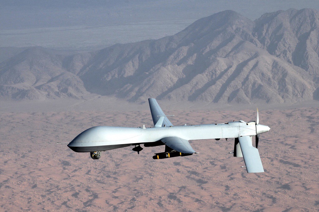
KAL 007
In 1983, Soviet fighters detected and shot down a large jet they may have believed was a US RC-135 reconnaissance aircraft–it wasn’t; it was Korean Airlines flight 007–all 269 passengers and crew were killed,including an American Congressman. As well as the RC-135 that was in the air that night, a number of carrier-launched reconnaissance aircraft had been overflying Soviet installations on the Kurile Islands for months as part of the naval component of the notorious NATO operation ABLE ARCHER 83. In Presidential lore, Reagan’s emotional reaction is said to have led to the declassification of GPS in 1983. Ostensibly, he believed that access to these positioning data could be prevent the sort of straying that led to the KAL 007 incident. This sort of emotional response and its ramifications might seem a bit far-fetched, but given his Reagan’s reaction to the TV movie “The Day After” might be less surprising (let’s not forget his zealous pursuit of comprehensive arms control):
Edmund Morris, Reagan’s official biographer, said the film left Reagan “dazed” and produced the only admission he could find in Reagan’s papers that he was “greatly depressed.” Four days later, he said, Reagan was “still fighting off the depression caused by The Day After. (David Hoffman, The Dead Hand p. 91)

The trajectory of KAL 007 into Soviet airspace (CIA)
Incidentally, KAL 007 is hardly the only accidental shoot down of a commercial aircraft to have geopolitical significance. Indeed, less than five years later the USS Vicennes would shoot down Iran Air flight 655 (while in Iran’s territorial waters; the plane was also over Iranian territory).
GPS Goes Public
This isn’t the beginning of GPS’s story, but it is a seminal point in public access to the network. The Defense Department’s NAVSTAR GPS program began in 1973, and the first satellite was launched in 1978he though the system was made public in 1983, it was not completed until 1993-995 (the network comprises–among other Earthbound parts of the system–24 1-ton satellites, though the original number was 11, then 18; the full 18 were up in 1985–these were the Block I set, the full 24 were part of the Block II program). There’s significant nuance to the dates, generation and number of the satellites that I’m glossing over here on my way to the point; the Wikipedia article is actually quite comprehensive .
Everyphone
Initially, GPS receivers were restricted to auto-bound or handheld devices used by more serious trekkers, eventually a more commodity-level rental car add-on, and now a normal component of the typical smartphone.
Earlier this year, it was revealed that the iPhone was storing the phone’s location data and even sending it periodically to Apple. Note that these were not actually GPS data but locations derived from cell towers and wi-fi hotspots. Apple’s response was that the data were anonymous and used to optimize services based on these data. One problem was the length of time the data were being stored (a year) and the fact that the file was unencrypted. This was addressed soon after by an iPhone firmware update; now the information is only stored for a week (this is, incidentally, not unique to the iPhone–Android captures these data as well). There was at least one successful case of the issue being taken to court in Korea.
This exposure was made by Alasdair Allen and Pete Warden. Somewhat balancing the Foucauldian power relationship, they released an application that would allow users to see these data on a visual map. To be honest, making lemonade until the firmware update I quite enjoyed looking at the data as a sort of Situationist memory device.

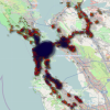
Personal trajectory

I also managed to get to... well, see for yourself
The first image hews clearly to the freeways of the Bay Area. Closer zooming gives you a clear enough matrix of locations that you could perhaps trace the streets of San Francisco without the underlaid map. Which reminds me not only of the previously-mentioned North Korea image but also the signature left by a number of cabs trawling the streets of SF via Stamen’s old Cabspotting webapp (good gravy, that was 2006!):

cabspotting.org
Panopticon 2.0
(as in Web 2.0–as in the user-contributed content sense)
I was meaning here to invoke check-ins on Facebook and the like via location-aware mobile devices. Looking up Foursquare, I find out they’re not without a sense of humor (or perhaps–unlike the 90s when I was apparently cleverer–the obvious)–I’ve now realized not so clever or cynical, as it was my own confused Googling. Still:

An amusing accident...
Crowdflow.net produced a wonderful visualization of the movement of 880 iPhones in Europe this April (submitted willingly of course!) I find it oddly similar–when not in motion–to the satellite image of North vs. South Korea at night posted in a prior Forever Overhead:
[youtube]http://www.youtube.com/watch?v=EI7yQnRy7QQ[/youtube]
And of course more conventionally, GPS data have been used for years to track the movements of criminals via anklets and other penal jewelry. The Atlantic has a wonderful article on this contemporary Panopticon.
Reagan’s original statement on KAL 007:
[youtube]http://www.youtube.com/watch?v=DTumUgLLyL0[/youtube]