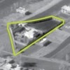
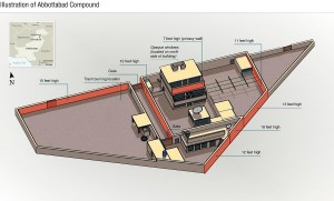
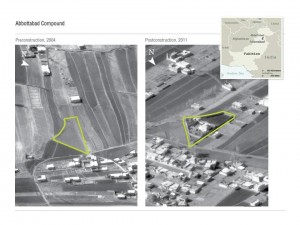
It’s been barely two days and already the shape of UBL’s compound has begun to take on an archetypal aspect, like Chernobyl or the gazebo at Dealy Plaza.
I’ll attach a number of my favorite visualizations and annotated maps below, but first have to quote Sara Reardon’s article about a geography professor who predicted UBL’s location back in 2009 (h/t Matthew Yglesias):
According to a probabilistic model they created, there was an 80.9% chance that bin Laden was hiding out in Abbottabad, Pakistan, where he was killed last night. And they correctly predicted that he would be in a large town, not a cave.
… Based on information from satellites and other remote sensing systems, and reports on his movements since his last known location, the students created a probabilistic model of where he was likely to be. Their prediction of a town was based on a geographical theory called “island biogeography”: basically, that a species on a large island is much less likely to go extinct following a catastrophic event than a species on a small one.
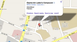
Returning to the titular topic, The Atlantic notes that the compound has already been notated on Google maps.
NYT has a typically wonderful wonderful set of visualizations, again cementing that delta-shaped perimeter in our minds.
I’m re-linking to WaPo’s rundown of the event, taking particular note of the details the preparation and burial of UBL’s body. This is because a dear friend had remarked on being reminded of the Iliad, specifically the dragging of Hector’s body by Achilles (now, though his man could–and probably has–read the Iliad in the original Greek, he assures me the sequence is quite well-known and requires no special knowledge of Homer). The Wikipedia summary is worth quoting:
After his death, Achilles slits Hector’s heels and passes the girdle that Ajax had given Hector through the slits of the heels. He then fastens the girdle to his chariot and drives his fallen enemy through the dust to the Danaan camp. For the next twelve days, Achilles mistreats the body, but it remains preserved from all injury by Apollo and Aphrodite.
This is the first of a series (under the rubric “Forever Overhead”) about satellite imagery, drones, aerial sensing–any overhead technology where the seen subject may be unaware of the specific instances of that seeing (a sort of vertical Panopticon). And also, the sometimes power-balancing effect of public access to these data. The topic for me is an old one, and, incidentally, the title is the same ad my favorite David Foster Wallace story.


